Animations!
Here are some truly fantastic animations, provided by Ernie Wright of NASA, that give wonderful VISUAL explanations of the eclipse!
Please be patient, as they may take a second to load!

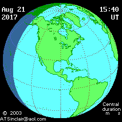
Overview of the shadow passing over the USA
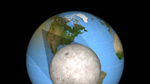
A "Moon's-eye" view of the eclipse!
You can see the Earth rotating during the eclipse; the Moon is also moving in its orbit, but you don't see that because you're traveling along with it!

A scale model of the Moon's shadow cutting across the surface of the Earth!
This one is our favorite, because it shows you the true scale of the eclipse, and how amazing it is to be a part of this cosmic alignment!

A great new animation, showing the Moon "scraping" its shadow across the Earth
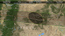
Overhead view of the shadow passing over the USA

Oblique view of the shadow passing over the USA

A visualization of the "rugged" nature of the Moon's shadow outline!
This one is absolutely amazing, because for the first time we are seeing not only the Moon's shadow outline corrected for the mountains and valleys on the lunar limb,
but also for the terrain on the Earth's surface! According to Michael Zeiler (the world's leading creator of eclipse maps), "Watch these animations carefully in the mountainous areas of Idaho and Wyoming. You will see how the corrected umbral figures drape very nicely around the mountains."
Michael and Xavier Jubier (a leading expert on eclipse calculations) have corroborated this data, and are working together with Ernie to refine our knowledge of eclipse "edge" calculations accordingly.
It is a great time to be an eclipse chaser - thanks Ernie! (What else would we expect from NASA?!)
We've written a program that lets you
see an animation of the actual eclipse from any location
you specify in the U.S.
To use the program, download
this
zip file, and unzip to one
directory. The ocx file should be in the same directory as
the exe, and you'll be good to go.
**PLEASE NOTE that for cities that are split by the path,
such as Nashville, St. Louis and Kansas City, you will see
the eclipse as viewed from the lat/long we chose to show
totality!
The eclipse is NOT total for all locations within those
cities! You must check out the Interactive
Google Earth map to find out if you will be in the path!
See a Google Earth file showing the eclipse shadow outline sweeping across the United States.
You should have the latest version of Google earth installed to use this.
Just download and unzip it -
you will see a KML file that can be directly opened in Google Earth.
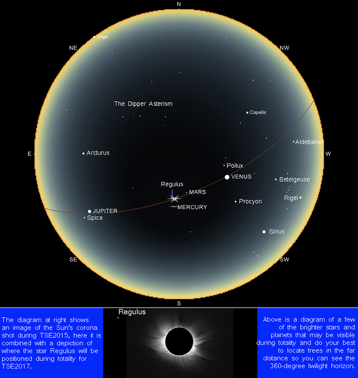
And finally, here is Andrew Sinclair's great eclipse animation:
(the little black dot must go over you, in
order for you to see totality!)


